
Colorado Springs Hikes
This page contains affiliate links. If you make a purchase via a link on this page, we make a small commission at absolutely no extra charge to you. Thank you for your support of this small women-led business.
5 Best Hiking Trails in Colorado Springs
Since we’re locals, we are often asked where to head to for the best Colorado Springs hikes.
There are so many fantastic hiking trails and outdoor recreation spots, it can be hard to figure out the best place to start.
While Garden of the Gods, Pikes Peak (the only Colorado Springs fourteener), and nearby Manitou Incline in Manitou Springs immediately come to mind as some of the best hikes in Colorado Springs, those deserve attention all on their own.
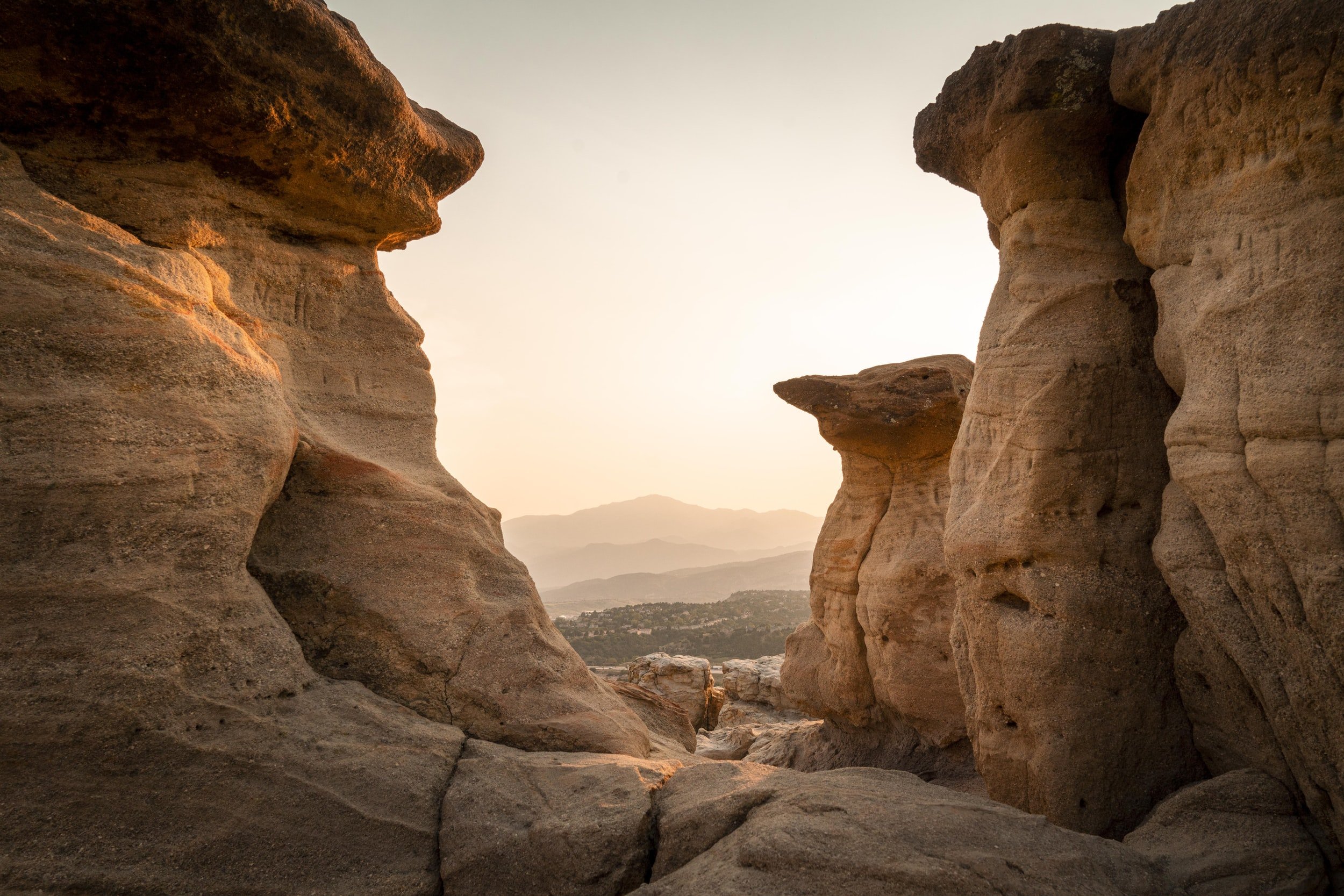
Garden of the Gods is one of the best spots in town for hiking in Colorado Springs
Here we’ll share our favorite hikes in Colorado Springs in the North Cheyenne Canyon area and nearby.
We’ll also share a fifth one that is one of the best hikes near Colorado Springs, accessible from the cute little town of Green Mountain Falls. You hike to see Catamount Falls in the Pikes Peak recreation area.
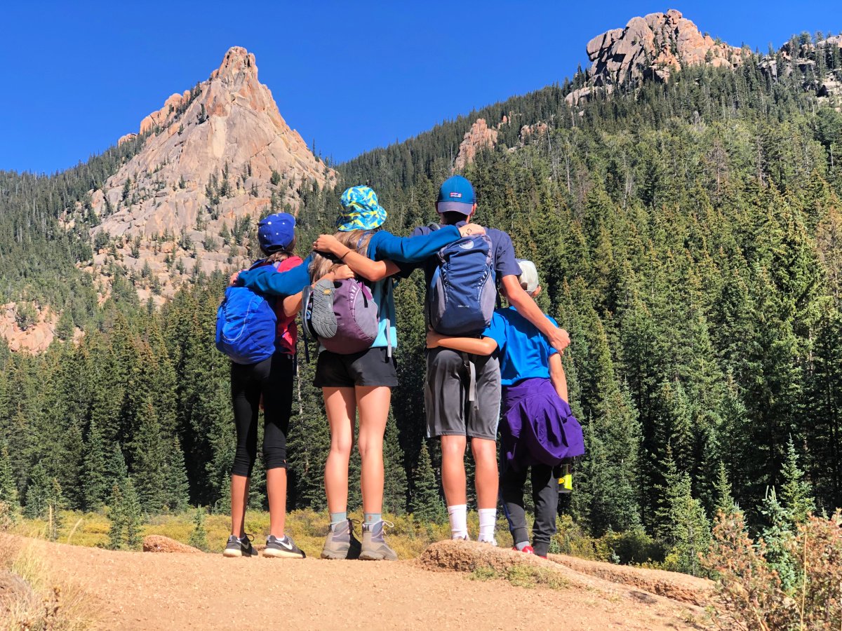
With each of these Colorado Springs hikes, we’ll give you some nitty gritty, good-to-know details such as difficulty of the hike, elevation gain, length of the hike in miles, what stands out about the hike, and how to reach the trailhead.
You’ll want a good hiking daypack for these hikes. We love Osprey’s Packfinder Tool.
At the end of each hiking trail overview, we’ll suggest a couple of fun places to go explore or share a meal, brews, or a sweat treat in the “HOP OVER HERE AFTER THE HIKE” section.

Seven Bridges is a popular hiking trail in Colorado Spring, so go during the week if you can.
Seven Bridges Trail
Trail Length: 3.8 miles Elevation Gain: 1,046 feet Route Type: Out and back Difficulty: Moderate
Trail Overview: Seven Bridges is one of the best hikes in Colorado Springs for families with young school age children and older.
The trail follows up along the North Cheyenne Creek and features waterfalls and seven numbered, sturdy wooden bridges crossing over the creek. It’s a steady uphill climb, but if you have kids along, they will beg to stop and play in the water, so take it slow and enjoy the hike at your leisure. Pack snacks and at least one liter of water per person. Wear sturdy tennis shoes or hiking shoes; bring your water sandals along if you like.
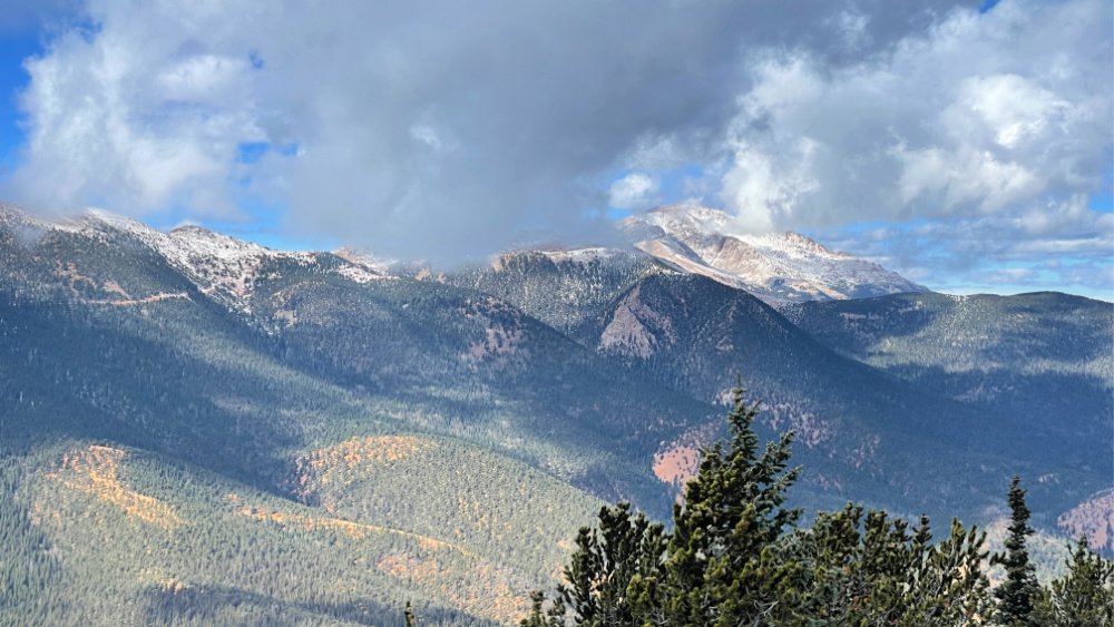
Pikes Peak is part of the sweeping views from challenging Mount Rosa
Looking for a good long, challenging loop hike that includes Seven Bridges? Try summiting Mount Rosa at 11,533 feet. We share 3 ways to reach Mt. Rosa, from where you can see Rosemount Reservoir, Pikes Peak, Almagre Mountain, Cheyenne Mountain, and the Sangre de Cristo mountain range. The 15 mile loop route is my favorite.
Good to Know: The Seven Bridges Trail is a favorite locally and with visitors, especially in the summer and on the weekends. During the school year, hit the trail during the week. In the summer, avoid the middle of the day when the trail often gets packed with locals and out-of-town visitors. Parking spots are more available early and late in the day. Give yourself at least 2 hours to enjoy this hike.
You’ll notice after the seventh bridge, that you can continue on more Colorado Springs hiking trails. Check out the hike to Loud’s Cabin below.
Love waterfall hiking trails? We cover 27 Waterfall Hikes in Colorado — our favorites all over the state.

This is a fun waterfall hike in Colorado Springs with kids
How to Reach the Trailhead: From I-25, you will exit west onto Tejon St. and then continue on Cheyenne Blvd. From there go right onto North Cheyenne Canyon Road; you will drive this past Helen Hunt Falls and all the way up until it dumps you in a dirt parking lot at Lower Gold Camp Road and High Drive.
Begin your hike at an unmarked metal gate on the northwest area of the parking lot (opposite Lower Gold Camp Rd and High Drive). Walk .7 miles on this gravel road until you reach hiking marker 622 on the right. You will see a small sign here saying North Cheyenne Creek.
Hop Over Here After the Hike:
Helen Hunt Falls You passed this on the way up, so you may as well stop. Appreciate the falls from the base, or head up to the small bridge across the falls. Feeling energetic? Climb the stairs a bit further to Silver Cascade Falls and enjoy fantastic views of the North Cheyenne Canyon.
Josh and John’s Ice Cream Made in Colorado Springs, this ice cream is churned 1/4 mile from the dairy Josh and John’s partners with. With flavors like Colorado Cookies and Cream, Purple Mountain Majesty, and Moose on the Loose, and Mocha Java Jolt , the is the perfect treat at the end of the trail. (11 East Pikes Peak Avenue or 6896 Centennial Blvd. are two closeby locations)

Palmer Trail (Section 16)
Trail Length: 5.7 miles Elevation Gain: 1,292 feet Route Type: Loop Difficulty: Moderate
Trail Overview: When you hop on Palmer Trail (Section 16) and begin the trail to the right, your hike starts out fairly easy and you may often find yourself in the sun during the first mile.
The second mile really begins to climb, but you’ll also end up on several switchbacks through the shaded pine tree forest. You’ll reach the summit after 2.3 miles and you’ll feel quite proud of yourself.
Find a good spot with a fantastic view for snack break or picnic lunch. From here, the rest of the hike is basically downhill and you’ll cruise around the rest of the loop enjoying the views all the way down.
Others like to start this hike to the left and do a more gradually incline up, with a steeper hike down. Choose whichever is best for your knees or your heart.
Good to Know: Palmer Trail is one of the best Colorado Springs hikes. This trail is also used by mountain bikers, trail runners, and horseback riders. To avoid crowds, go during the week and arrive early in the day or later in the afternoon, especially on long summer days. This trail is best hiked in March until November. Give yourself 3-4 hours to enjoy this hike.
You’ll want a solid daypack for this fabulous hike.
How to Reach the Trailhead: Located in Bear Creek Canon Park, the parking lot for PalmerTrail (Section 16) is found off Gold Camp Road. To get there from US-24: exit on 26th street and after driving through two switchbacks, turn right to Gold Camp Road and the trailhead parking lot will be on the right side after about 0.9 miles.
Hop Over Here After the Hike:
Rudy’s Bar-B-Q Texas barbecue for breakfast, lunch, or dinner. Go early or mid-afternoon to avoid long lines. (315 S 31st St, Colorado Springs)
Cerberus Brewing Chill brew pub — with fantastic outdoor seating — serving up more than 20 in-house and guest craft brews on tap and amazing brisket grilled cheesed sandwiches. (702 West Colorado Avenue, Colorado Springs)

Mount Muscoco Trail
Trail Length: 4.0 miles Elevation Gain: 1,292 feet Route Type: Out and back Difficulty: Moderate
Trail Overview: Although the trail to Mount Muscoco isn’t that long, it is a steady uphill climb and ranks a bit on the tougher side of a moderate hike. Make sure you have a lot of water and some good snacks. The trail is marked well and the 360 views at the top are worth it. Some scrambling at the end, but very doable. If you have kids along, let them stick their feet in the creek at the end of the hike before you get back in the car.
Good to Know: A great family hike in Colorado Springs, you can hike this with elementary aged kids and older. The Mount Muscoco trailhead is the same one for Mount Cutler; you can add on Mount Cutler on your way back down from Mount Muscoco. Dogs are allowed on this trail as long as they are on leash. Best hiked May until November. Allow yourself at least 2 - 2.5 hours for this hike.
How to Reach the Trailhead: Mount Muscoco Trail starts just off of North Cheyenne Canyon Road in North Cheyenne Canon Park. From I-25, take exit 140 to Tejon Street. Take Tejon to Cheyenne Boulevard, where you’ll eventually turn right onto North Cheyenne Canyon Road (at the Starsmore Discovery Center) to enter the canyon. Trailhead parking for Muscoco Mountain and Mt. Cutler is on the left side after 1.5 miles.
Brush up on Beginners Hiking Tips — great reminders for experienced and new hikers alike.
Hop Over Here After the Hike:
Ziplining over Seven Falls An elevated, thrilling ride with older kids and teenager! Get 10% off your zip line tour with Broadmoor Soaring Adventure. (6 Lake Avenue, Colorado Springs)
Bristol Brewery & Pub at Ivywild School This busy local brewery calls an old elementary school home and serves up craft beers and great appetizers and pub plates. (1604 South Cascade Avenue, Colorado Springs)

Hiking to Loud’s Cabin is one of the best Colorado Springs hikes — an overlooked hidden gem in any season.
Loud’s Cabin
Trail Length: 6.2 miles Elevation Gain: 1,778 feet Route Type: Out and back Difficulty: Moderate
Trail Overview: If you are looking for a longer day hike that includes Seven Bridges Trail, then this is your trail. Colorado Springs hiking trails in North Cheyenne Canyon are tough to beat.
Once you enjoy your way up North Cheyenne Creek crossing all seven bridges with fantastic views, then you will continue climbing along the creek until the trail forks and you head right on Trail 622A towards Loud’s Cabin. Waterfalls, a creek, beautiful meadow, Aspens, and an old cabin make this an all-time favorite hike.
This trail is very well marked with posts in the ground. Just pay attention. You will come upon a sweet meadow and beautiful Aspen trees. Then you will cross a bridge over Bear Creek. There will be another small bridge crossing right before Loud’s Cabin. Find a sweet spot to revel in history and enjoy a snack or a picnic lunch before you head back down. Give yourself 3-4 hours to enjoy this longer hike.

Hike in Colorado Springs to Loud’s Cabin past Seven Bridges
Good to Know: While hiking past Seven Bridges to Loud’s Cabin, you’ll notice this trail is not as busy and you may realize you are in an area known as Jones Park, where many trails converge, making this area around Mount Kineo fun to explore again. Just pay attention to the trail markers and that you stay on 622 to 622A going up and vice versa on the way back down. Dog on leash allowed. Best hiked March until December. May need spikes and poles in spring.
How to Reach the Trailhead: From I-25, you will exit west onto Tejon St. and then continue on Cheyenne Blvd. From there go right onto North Cheyenne Canyon Road; you will drive this past Helen Hunt Falls and all the way up until it dumps you in a dirt parking lot at Lower Gold Camp Road and High Drive.
Begin your hike at an unmarked metal gate on the northwest area of the parking lot (opposite Lower Gold Camp Rd and High Drive. Walk .7 miles on this gravel road until you reach hiking marker 622 to Seven Bridges Trail (Trail 622) on the right. After the seventh bridge, continue on up around Mount Kineo and look for the marker for Trail 622A up to Loud’s Cabin.
Hop Over Here After the Hike:
The Wild Goose Meeting House A local, cozy Colorado Springs cafe serving up coffee drinks, craft beers, and yummy eats like Breakfast Nachos and the hot Gander sandwich with Red Pepper Gouda Bisque. Desserts and a kids menu too. (401 N. Tejon St, Colorado Springs)
Bingo Burger Gourmet hamburgers, yummy sauces, beer, and delicious milkshakes served up in a bright, funky space. (132 N Tejon, Colorado Springs)
Catamount Falls Trail
Trail Length: 5.8 miles Elevation Gain: 1,646 feet Route Type: Out and back Difficulty: Moderate
Trail Overview: Not technically in Colorado Springs, this is a favorite hike near Colorado Springs and it’s just a few minutes up the road.
Catamount Falls Trail starts off at a pretty good clip uphill with stops for a town overlook, then a chance to take a breather in the sun or the shade at the top of the saddle. Then the trail levels out and meanders along a picturesque creekside meadow before a final uphill jaunt along the gradual Catamount Falls. Finally, you will reach the reservoir. This trail changes terrain and views and includes such a nice variety, like huge granite boulders in the meadow.
Good to Know: While not located in Colorado Springs, this trail to Catamount Falls and Reservoir is found in Green Mountain Falls just up US-24, past the entrance to the Pikes Peak Hwy. So it’s not far from the heart of the city. Dogs on leash allowed. Best hiked June through October. For Colorado Springs hikes in winter or spring, you’ll definitely need spikes and poles. Older elementary kids would enjoy this hike. Allow yourself 3-4 hours for this hike. The trail is well marked along the way.

How to Reach the Trailhead: From US-24 going west, exit to the left to the sweet little town of Green Mountain Falls. Your best bet for parking is on Lake Street by the lake. You cannot park at the end of either one of the access streets: Hondo Avenue and Belvidere Avenue. You will start on foot from the lake and up either avenue, which will dump you by the trailhead.
Hop Over Here After the Hike:
Pantry Restaurant Serving up breakfast and entrees all day long since the 1950s, this old-timey place sits along the creek. Just walk over here right after you finish your hike. (6980 Lake St, Green Mountain Falls, CO)
Pikes Peak Highway Worth the drive, toll, and scenic stops for fantastic views atop America’s Mountain at 14,115' feet.
These five best hiking trails in Colorado Springs offer different scenic views and sweet time in nature with friends or family. North Cheyenne Canyon is a gorgeous outdoor recreation area with lots of nearby options for things to do after your hike.
More Hikes Near Colorado Springs Co
Melody shares all the best tips for when and how to hike Pikes Peak.
We also love hiking in Palmer Lake.
Sitting on the north side of Colorado Springs, Palmer Lake is a fun little town resting up against the Rocky Mountain foothills.
Next door to the town of Monument, Palmer Lake is one of three communities that make up the Tri-Lakes region. Palmer Lake sits on Palmer Divide at 7,200 feet, the highest elevation you’ll hit when driving from Colorado Springs to Denver.
With it’s own unique wild west history, fabulous hikes, and a regional recreation area, you can see why families love to visit and hike Palmer Lake.
More fabulous hiking trails near Colorado Springs can be found just north in Palmer Lake
What to Wear Hiking in Colorado
When it comes to hiking in Colorado, the whole “what do I wear” struggle is real. We reallhy do experience all four seasons, sometimes all in one day!
Between the altitude, elevation gain, and changing weather, might end up hauling 20 lbs of gear without adding water and snacks. Whew!
As experienced locals, we have your Colorado hiking checklist loaded and ready.

Let’s Talk
Pick our brains about hiking trails in Colorado Springs and beyond. Book a one hour call with us and get knowledgable advice and tips. We write curated itineraries too.
Short and Easy Hikes in Colorado Springs
While high adventure, adrenaline thrilling outdoor adventures can be fun, there is something comforting about the reliable, and yet still beautiful, easy hike.
With over 20 years of living in Colorado Springs under my belt, Melody shares a few more short and easy dependable trails she hikes on repeat.
Hiking with kids can be really fun when you start out prepared
Best Colorado Hikes to Take Kids On
Introducing your children to hiking in Colorado is an exciting but often frustrating task. Hiking with kids is of a lot of strolling, stopping and snacking.
Add in altitude and hill climbing and well, you could face some challenges if you’re not prepared.
As veteran hiking moms, we’ve dealt with our fair share of grumbling kids during family hikes. Read more about how to make hiking fun with kids by using these tried and true hiking tips on some favorite Colorado trails.
Colorado Springs Hiking Advice
As a two person team, we offer experienced advice about the best Colorado Springs hikes.
We are Wilderness First Aid trained, insured, permitted and so much more.
Book a call with us today. We can even create personalized hiking itineraries curated just for you.
Colorado Springs Vacation Homes Just Minutes From Your Hiking Adventures
One of Colorado’s most popular vacation destinations, Colorado Springs is your ideal place for booking a sweet vacation home in the heart of hiking and outdoor adventures.
Get 20% OFF Newly Listed Vacation Homes.
This historic town is filled with fun attractions such as the towering Pikes Peak mountain and the Garden of the Gods Visitor & Nature Center.
Hike at the Broadmoor Seven Falls for amazing waterfalls. Colorado Springs is a popular base for sports in all seasons, from skiing and snowboarding in winter and of course hiking and biking in summer.
Kids love Cheyenne Mountain Zoo one of our nation’s top zoos and the North Pole Colorado Santa's Workshop, a Christmas-themed amusement park.
Colorado Trail Maps for the Colorado Springs Area
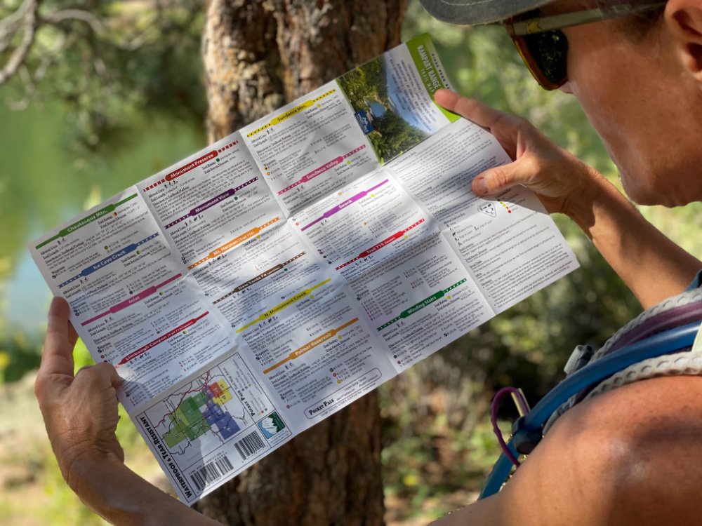
While we also use digital maps, here are a few top reasons we love unfolding physical paper maps before, during and after a trip:
Great for planning out hiking trips, paper maps help you get an overall view of the Colorado trails you are hiking before you go
Anything dependent on batteries can’t be considered 100 per cent reliable, including the best GPS devices.
Having a physical map can be a life saver if all your devices die
Waterproof and tear-resistant paper maps by Pocket Pals Trail Maps fold down small and nicely and are great for planning your next trip on Colorado hiking trails.
Colorado Hikes and Hops readers get get 10% off each order when you use the coupon code "10%OFF" here.

An example of Pikes Peak Area Map for Palmer Lake Reservoir Area Trails and more
Pocket Pals Trail Maps Available:
Pikes Peak Region Series
Colorado Springs Series (City wide parks, trails, recreation areas, Garden of the Gods, North Cheyenne Canyon, Red Rock Open Space, Cheyenne Mountain State Park)
Colorado 14ers Series
Colorado State Parks
Pike National Forest - Recreation Area Series
Map Bundles
Digital (GEO PDF) download options as well
Buy Both Paper and Digital Map Bundles and save 15%
More Colorado Springs Hikes
Since we have the amazing privilege of living in Colorado Springs, we cover a lot of bucket list hikes in our backyard:
Garden of the Gods hiking trails that don’t disappoint
Inside Colorado’s Fourteeners - including Pikes Peak
Tackle the Manitou Incline — over 2,700 steps in less than a mile
Red Rock Canyon is one of Colorado Springs best open spaces with lots of great hiking and biking trails
Beginners Hiking Tips — Great reminders for Colorado natives and novices alike
YOU MAY ALSO WANT TO READ:
Paddleboarding in Colorado: The Best Spots in the State
27 Waterfall Hikes That Can’t Be Missed
